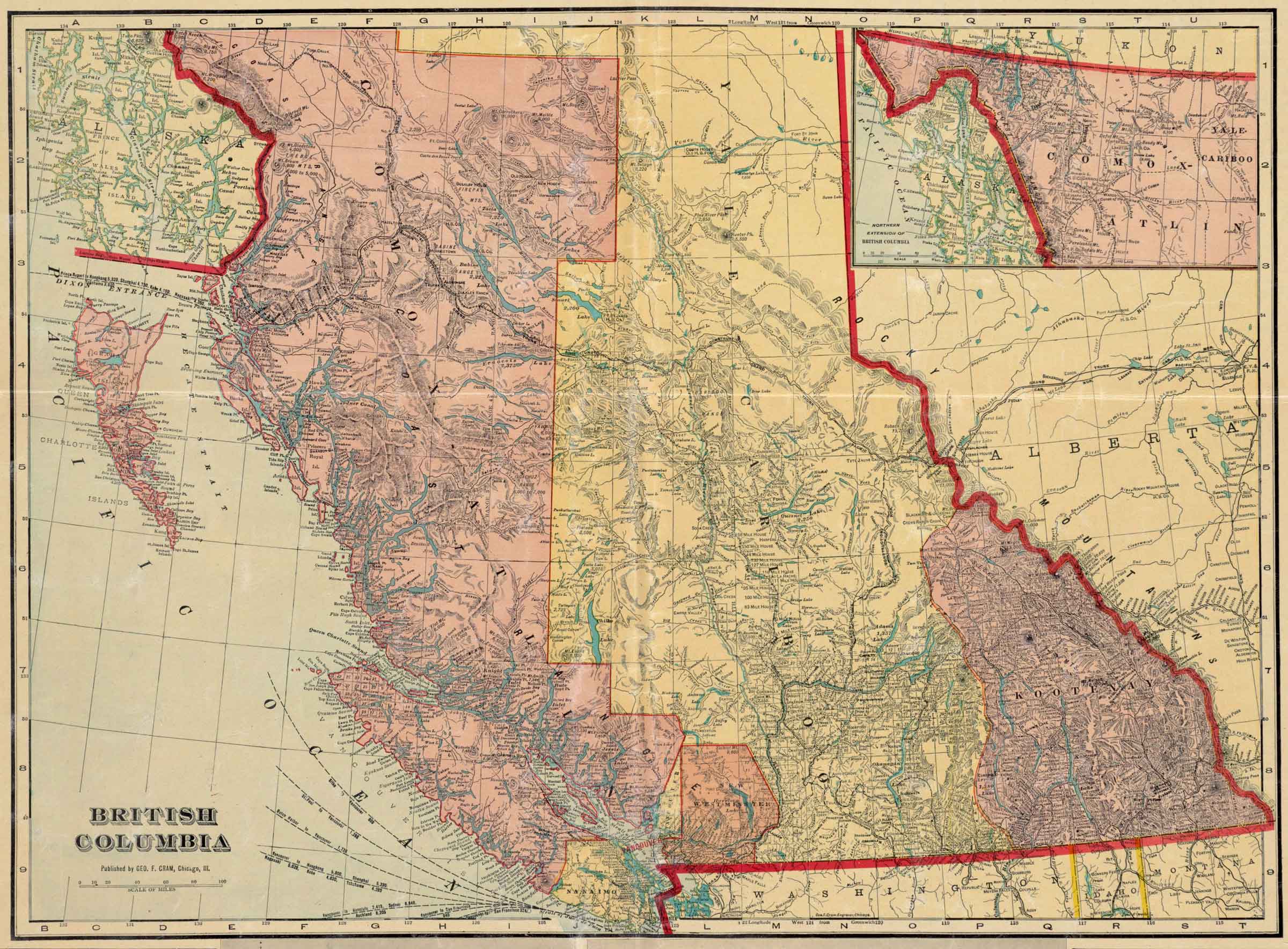
British Columbia.
Published by Geo. F. Cram, Chicago,Ill.
Norman B. Leventhal Map & Education Center
![British Columbia [detail].
Published by Geo. F. Cram, Chicago,Ill.](/wp-content/uploads/2024/12/map-cram-british_columbia-1913-detail.jpg)
British Columbia [detail].
Published by Geo. F. Cram, Chicago,Ill.
Norman B. Leventhal Map & Education Center
George Franklin Cram [1842-1928] was an American map publisher. He served in the U.S. Army during the American Civil War. Upon mustering out he joined his uncle Rufus Blanchard’s Evanston, Illinois, map business in 1867. Two years later, he became sole proprietor of the firm and renamed it the George F. Cram Co. which became a leading map firm in the United States.
The map indicates the constructon of both the Grand Trunk Pacific Railwayand the Canadian Northern Railway, both traversing the Yellowhead Pass and branching at Tête Jaune Cache.
On the Grand Trunk route following the Fraser River between Tête Jaune Cache and Fort George there are no settlements indicated. South of Tête Jaune Cache the first settlements along the CNoR are near Kamloops on the North Thompson River.
Athabasca River
Athabasca Pass
Bad River (James Creek)
Baker Creek (Canoe)
Baptiste River
Bear River
Boat Encampment
Mount Brown [as “Mt. Brown 9,050”]
Brûlé Lake [as “Burnt Lake”]
Canoe River
Cranberry Lake
Finlay River
Fitzhugh
Foster Creek
Geikie
Mount Geikie
Goat River
Grand Forks River
Henry House
Mount Hooker
Edward Worrell Jarvis [1846–1894]
Jarvis Cache
Jasper Lake
Jasper House
Kinbasket Lake
Little Smoky River (Morkill)
Lucerne (GTP railway point)
Maligne River
Moose Lake
Fraser River North Fork
North Branch of North Fork Fraser River
North Thompson River
Parsnip River
Peace River
Rainbow (GTP railway point)
Rau’ Shuswap
Resplendent (GTP railway point)
Mount Robson [as “Robson Pk. 13,700”]
Sand Creek
Small Creek [as “Small R.”]
Smoky River
Snake Indian River
South Branch of North Fork Fraser River
South Fork Fraser River
Swiftcurrent Creek
Swift Creek
Swiftwater
Tête Jaune Cache
Wapiti River
Whirlpool River
Wood River
Yellowhead Lake
Yellowhead (railway point)
- Wikipedia. George F. Cram