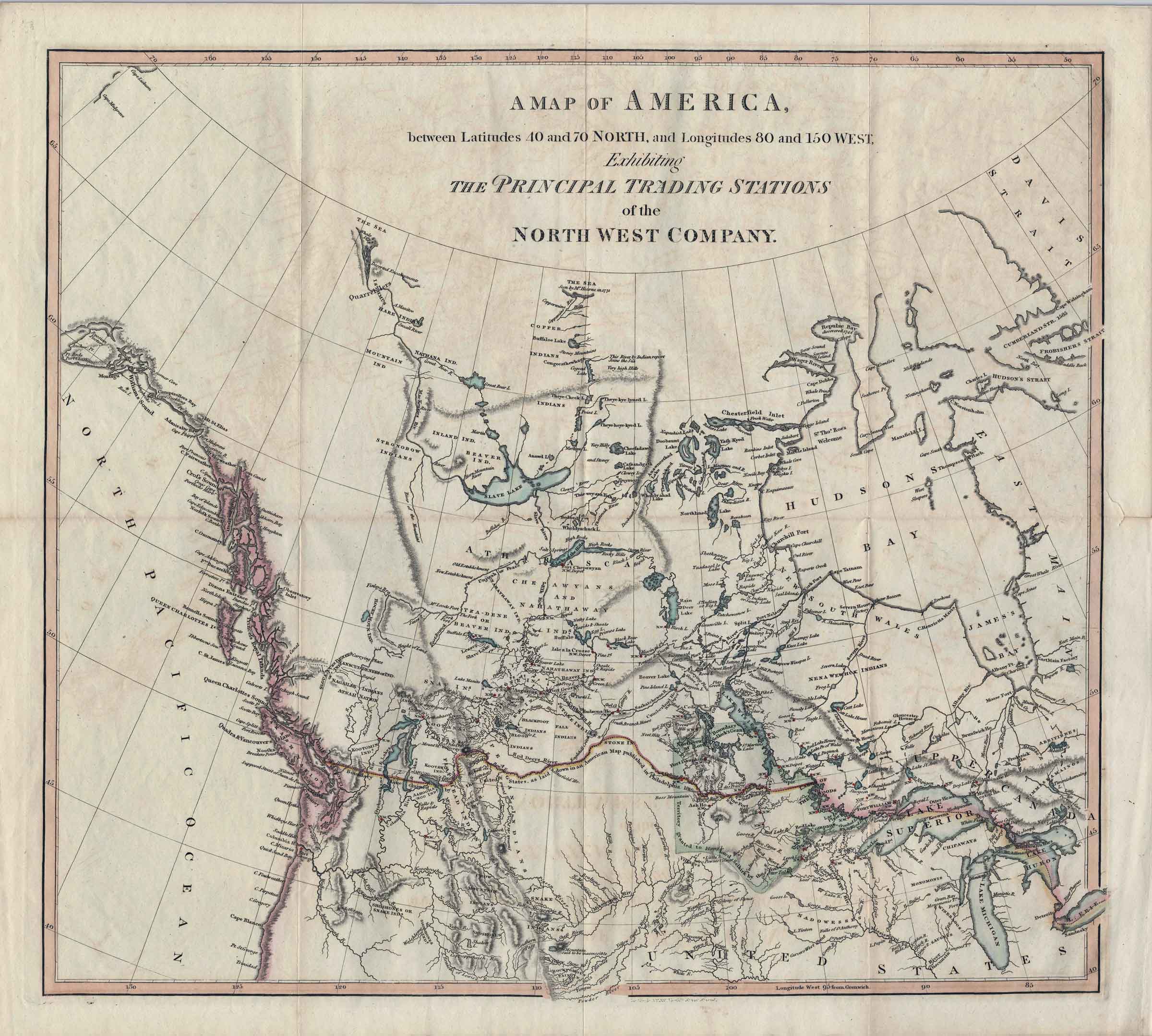
A map exhibiting the principal trading stations of the North-West Company. 1817 University of British Columbia Library
![A map exhibiting the principal trading stations of the North-West Company. 1817 [detail]](/wp-content/uploads/2025/01/1817-McGillivray-Notice-detail.jpg)
A map exhibiting the principal trading stations of the North-West Company. 1817 [detail] University of British Columbia Library
A map of America, between latitudes 40° and 70° North, and longitudes 80° and 150° West; exhibiting the principal trading stations of the North-West Company; and intended to accompany the narrative of occurrences in the Indian countries of North America, connected with the Earl of Selkirk, the Hudson’s Bay and the North-West Companies.
Appears to be based on Sax’s map of North America.
[The Earl of Selkirk referred to was Thomas Douglas, 5th Earl of Selkirk [1771–1820], who established the Red River Colony in 1812 in what in now Manitoba.]
The map appears in Notice respecting the boundary between His Majesty’s possessions in North America and the United States, 1817, attributed to Simon McGillivray [1785–1840].
McGillivray played a role in merging the family owned North West Company with the rival Hudson’s Bay Company.
On the map there is a note near the head of Canoe River: “Snare Inds. (now destroyed)”
Athabasca Country
Athabasca Pass
Canoe River
Canoe Encampment [A NWC post indicated here]
Finlay River [as “Finlay’s Bra.”]
Fraser River [as “Fraser’s R.”]
Mackenzie River [as “MacKenzie Riv.”]
Peace River [as “Unjigah or Peace R.”]
Unjigah River [as “Unjigah or Peace R.”]
- McGillivray, Simon [1785–1840], attributed. Notice respecting the boundary between His Majesty’s possessions in North America and the United States; with a map of America, between latitudes 40° and 70° North, and longitudes 80° and 150° West; exhibiting the principal trading stations of the North-West Company; and intended to accompany the narrative of occurrences in the Indian countries of North America, connected with the Earl of Selkirk, the Hudson’s Bay and the North-West Companies. London: B. McMillan, 1817. University of British Columbia Library