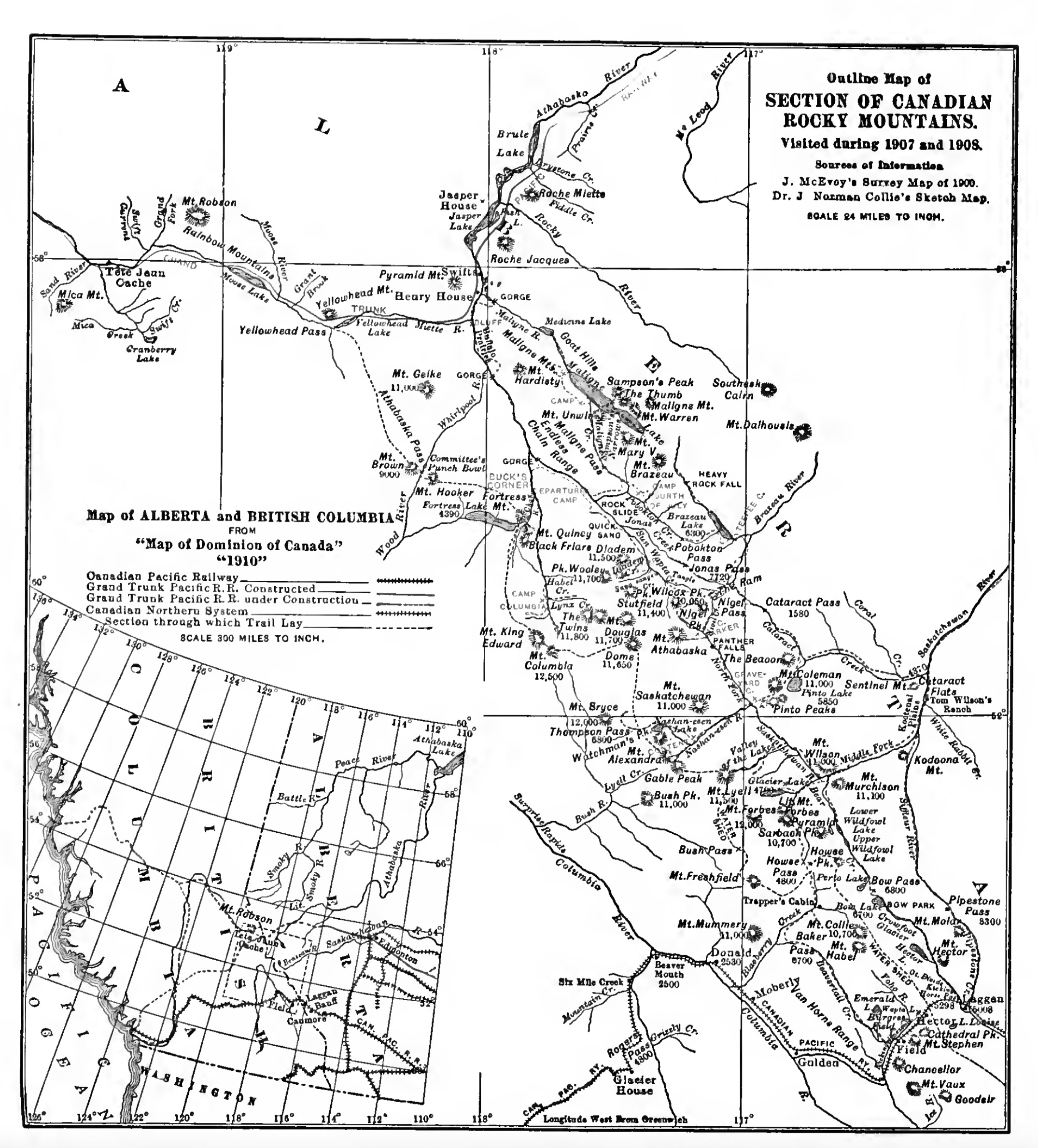
Section of Canadian Rocky Mountains visited during 1907 and 1908
Internet Archive
Outline Map of
SECTION OF CANADIAN ROCKY MOUNTAINS.
Visited during 1907 and 1908.
Sources of information : J. McEvoy’s Survey Map of 1900, Dr. J. Norman Collie’s Sketch Map
Insert: Map of Alberta and British Columbia from “Map of Dominion of Canada 1910.” Shows railway routes, constructed and proposed: Canadian Pacific Railway, Grand Trunk Pacific Railway, Canadian Northern Railway.
Mary T. S. Schäffer Warren [1861–1939] explored around Mount Robson in 1908, shortly before the arrival of the Grand Trunk Pacific. This map accompanied the account of her travels, Old Indian Trails.
This map includes:
Athabasca Pass
Athabasca River
Mount Brown
Brûlé Lake
Buffalo Prairie
Committee Punch Bowl
Cranberry Lake
Fortress Lake
Mount Geikie
Grand Fork
Grant Brook
Henry House
Mount Hooker
Jasper House
Jasper Lake
Mica Mountain
Mica Creek
Miette River
Moose River
Moose Lake
Rainbow Range [as Rainbow Mountains]
Roche Miette
Sand Creek
Swiftcurrent Creek
Swift (railway point)
Swift Creek
Tête Jaune Cache [as Tête Jaun Cache]
Whirlpool River
Wood River
Yellowhead Pass
Yellowhead Lake
References:
- Schäffer Warren, Mary T. S. [1861–1939]. Old Indian trails. Incidents of camp and trail life, covering two years’ exploration through the Rocky Mountains of Canada. [1907 and 1908]. New York: Putnam, 1911, p. 361. Internet Archive