Former name for Willow River
54.0864 N 122.5078 W Google — GeoHack
Not currently an official name.
Palliser Map 1863
BC Lands Central BC 1892
Cram’s map British Columbia 1913
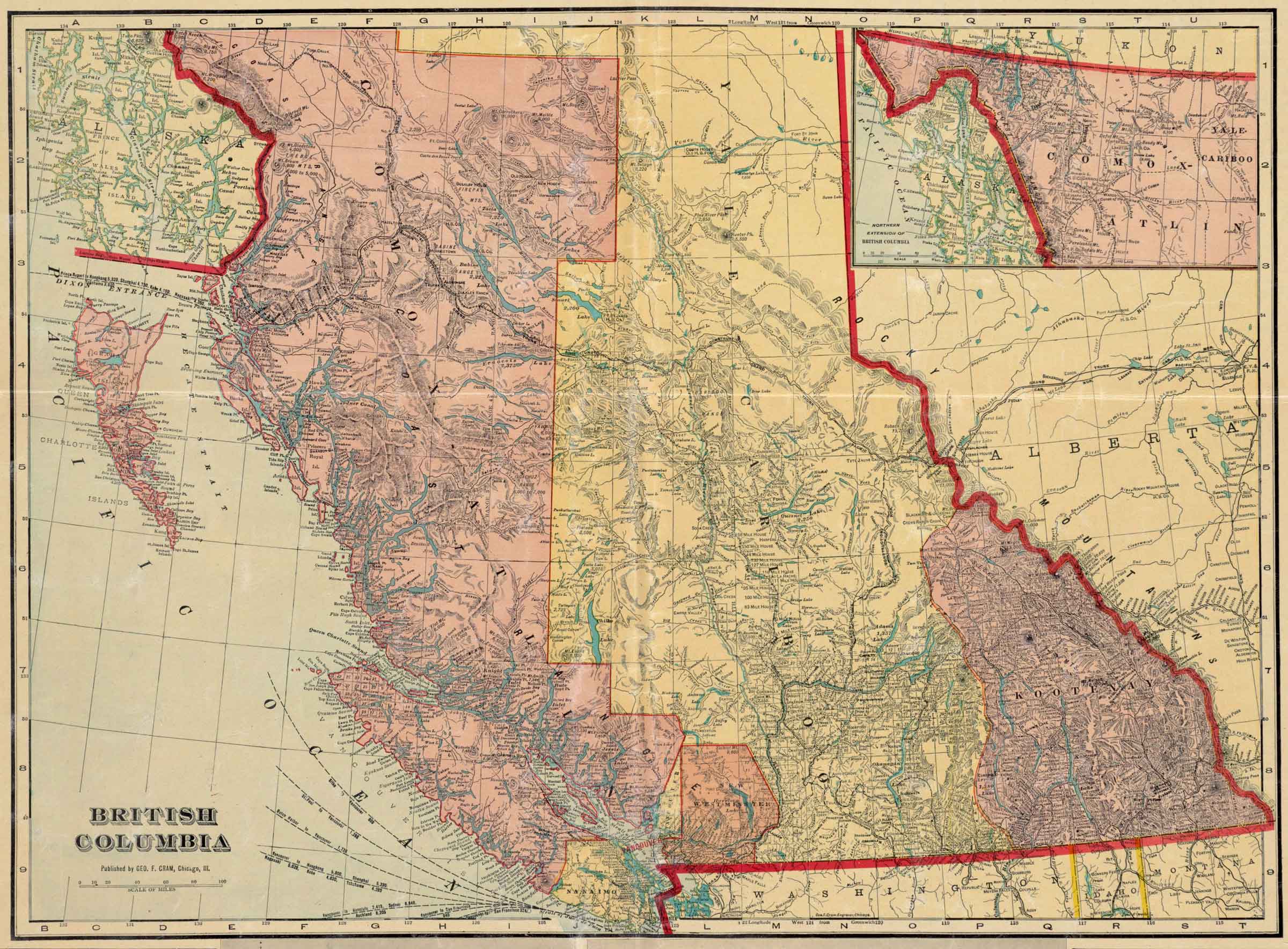
British Columbia.
Published by Geo. F. Cram, Chicago,Ill.
Norman B. Leventhal Map & Education Center
British Columbia [detail].
Published by Geo. F. Cram, Chicago,Ill.
Norman B. Leventhal Map & Education Center
George Franklin Cram [1842-1928] was an American map publisher. He served in the U.S. Army during the American Civil War. Upon mustering out he joined his uncle Rufus Blanchard’s Evanston, Illinois, map business in 1867. Two years later, he became sole proprietor of the firm and renamed it the George F. Cram Co. which became a leading map firm in the United States.
The map indicates the constructon of both the Grand Trunk Pacific Railwayand the Canadian Northern Railway, both traversing the Yellowhead Pass and branching at Tête Jaune Cache.
On the Grand Trunk route following the Fraser River between Tête Jaune Cache and Fort George there are no settlements indicated. South of Tête Jaune Cache the first settlements along the CNoR are near Kamloops on the North Thompson River.
Peter Pond’s maps of 1785 and 1787 refer to the River of Peace.
Other names have included Un-ja-ga/Unjigah, as recorded on a map to accompany Mackenzie’s “Voyage to the Pacific… 1793”