Approximately 12 km north of Jasper on the topo map
52.9867 N 118.0628 W — Map 083D16 — Google — GeoHack
Name officially adopted in 1951
Topo map from Canadian Geographical Names
Grand Trunk Pacific Railway station built in 1911
Palliser Map 1863 [as “Miette or Henry Ho.”]
Milton and Cheadle’s map 1865
Trutch’s map of BC 1871
Hanington’s map Smoky River Pass 1875
Tolmie and Dawson map Indian Tribes of BC 1884
BC Lands Central BC 1892
Brownlee’s map Province of BC 1893
Frederick Talbot’s map GTP 1910
Schäffer map of visits in 1907 and 1908
Grand Trunk Pacific Railway map [ca. 1912]
Cram’s map British Columbia 1913
Grand Trunk Pacific Railway ticket 1914
Grand Trunk Pacific Railway map ca. 1918
Grand Trunk Pacific Railway map 1919
Northern Alberta 1919 map
Grand Trunk Pacific Railway stations
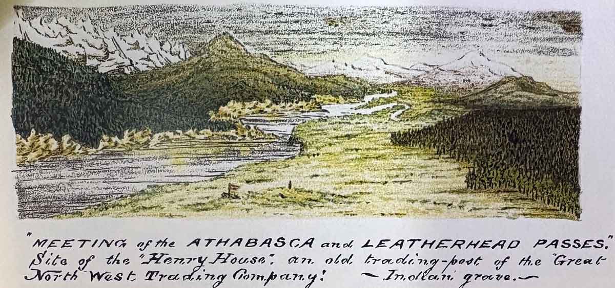
“Meeting of the Athabasca and Leatherhead Passes. Site of the ‘Henry House,’ an old trading-post of the Great North West Trading Company! — Indian grave— Rylatt p. 131
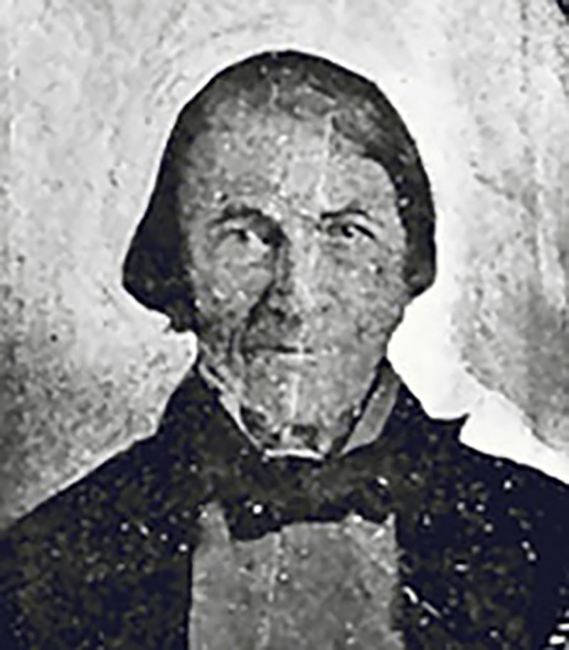
William Henry (1784-1864). From “Travels and Adventures” (Bain, ed., Boston, 1901 Red River Ancestry
“Henry’s House” or “William Henry’s Old House” was a minor North West Company [1779–1821] trading post on the route to Athabasca Pass. In 1811, while David Thompson [1770–1857] was making the first recorded crossing the pass, William Henry, the eldest son of Alexander Henry [1739–1824], provided support on the eastern side of the mountains.
Henry built a post on the Athabasca River near the mouth of the Miette River, where the trails from the Athabasca and Yellowhead passes reached the head of navigation.
- Henry, Alexander [1739–1824]. Travels and adventures in Canada and the Indian territories, Between the Years 1760 and 1776. In two parts. New York: Riley, 1809. Internet Archive
- Rylatt, Robert M. [fl. mid-1800s]. Surveying the Canadian Pacific: Memoir of a Railroad Pioneer. Salt Lake City: University of Utah Press, 1991
- Still, Gary [1939–2018]. William Henry (1784-1864). 2014 Red River Ancestry [accessed 27 February 2025].
- Karamitsanis, Aphrodite [1961–]. Place names of Alberta. Volume 1: Mountains, Mountain Parks and Foothills. Calgary: University of Calgary Press, 1991. Internet Archive
- Bohi, Charles W., and Kozma, Leslie S. Canadian National’s Western Stations. Don Mills, Ontario: Fitzhenry & Whiteside, 2002
- Still, Gary [1939–2018]. William Henry (1784-1864). 2014 Red River Ancestry [accessed 27 February 2025].
- Wikipedia. Henry House


