
Map of Mount Robson based on expeditions in 1907 and 1908. By A. P. Coleman. Canadian Alpine Journal, 1910
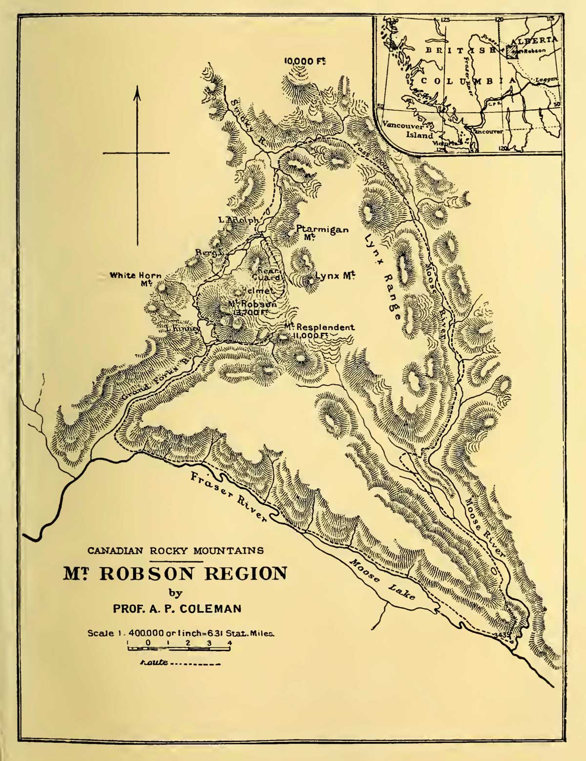
Mt. Robson Region map by A. P. Coleman, 1911 The Canadian Rockies : new and old trails, p. 264 [accessed 15 February 2025]
Canadian geologist Arthur Philemon Coleman [1852–1939] made extensive early explorations of the Canadian Rockies, including the first attempts to climb Mount Robson in 1907 and 1908.
This map includes:
Adolphus Lake [as “L. Adolph”]
Berg Lake
Grand Forks River
The Helmet [as “Helmet”]
Kinney Lake [as “L. Kinney”]
Lynx Mountain [also “Lynx Range”]
Moose River
Moose Lake
Ptarmigan Mountain
Rearguard Mountain [as “Rear Guard”]
Resplendent Mountain
Mount Robson
Smoky River
Whitehorn Mountain [as “White Horn Mt.”]
References:
- Coleman, Arthur Philemon [1852–1939]. “Expedition to Mt. Robson.” Canadian Alpine Journal, Vol. 1, No. 2 (1908):100-103. Alpine Club of Canada [accessed 2 April 2025]
- Coleman, Arthur Philemon [1852–1939]. “Geology and glacial features of Mt. Robson.” Canadian Alpine Journal, Vol. 2, No. 2 (1910):73-78. Alpine Club of Canada [accessed 2 April 2025]
- Coleman, Arthur Philemon [1852–1939]. “Mount Robson, the Highest Point in the Canadian Rockies.” The Geographical Journal (London), Vol. 36, No. 1 (July 1910). JSTOR [accessed 3 March 2025]
- Coleman, Arthur Philemon [1852–1939]. The Canadian Rockies: New and Old Trails. London: T. Fisher Unwin, 1911. Internet Archive [accessed 3 March 2025]
Also see: