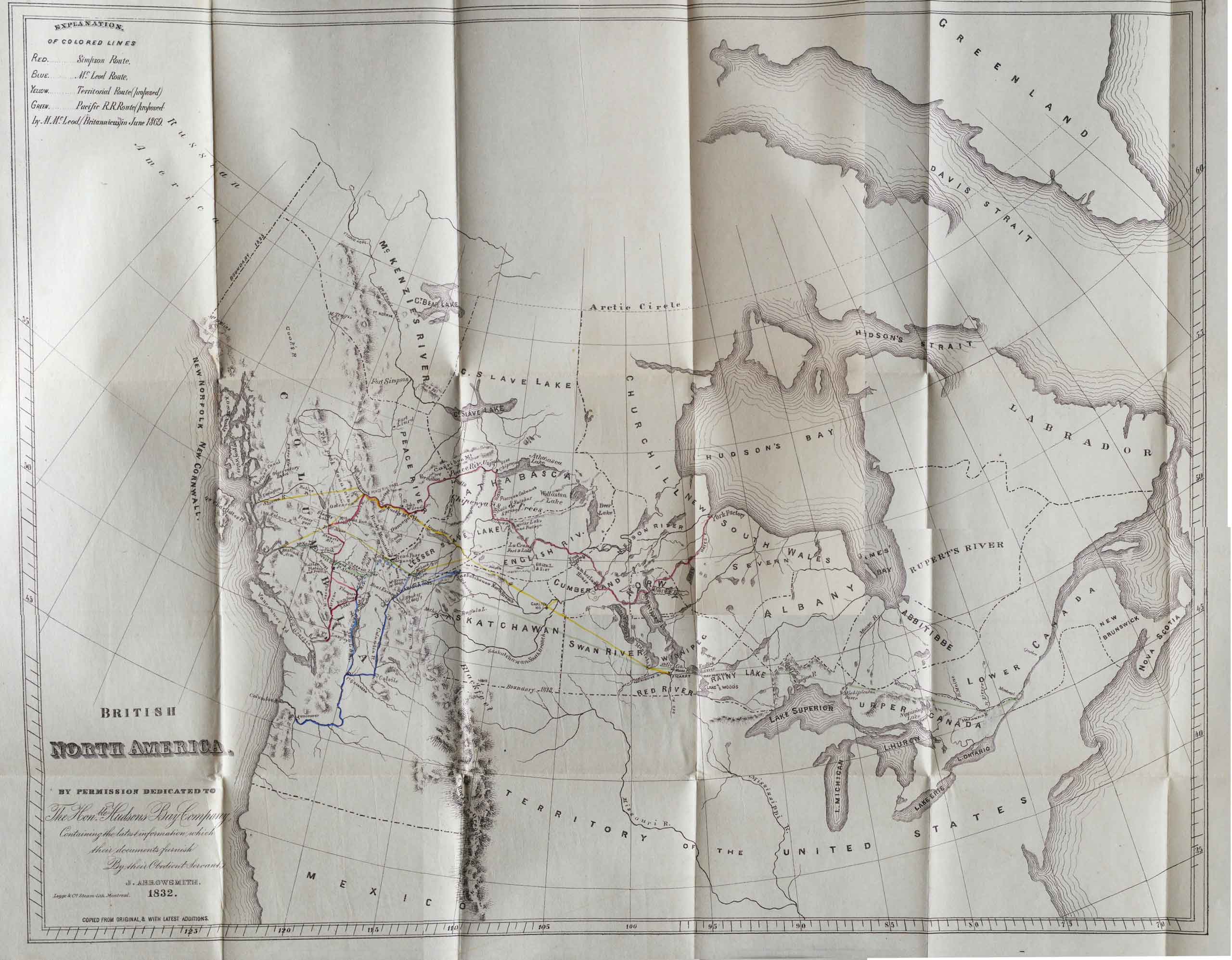
J. Arrowsmith, 1832. British North America
University of British Columbia Library
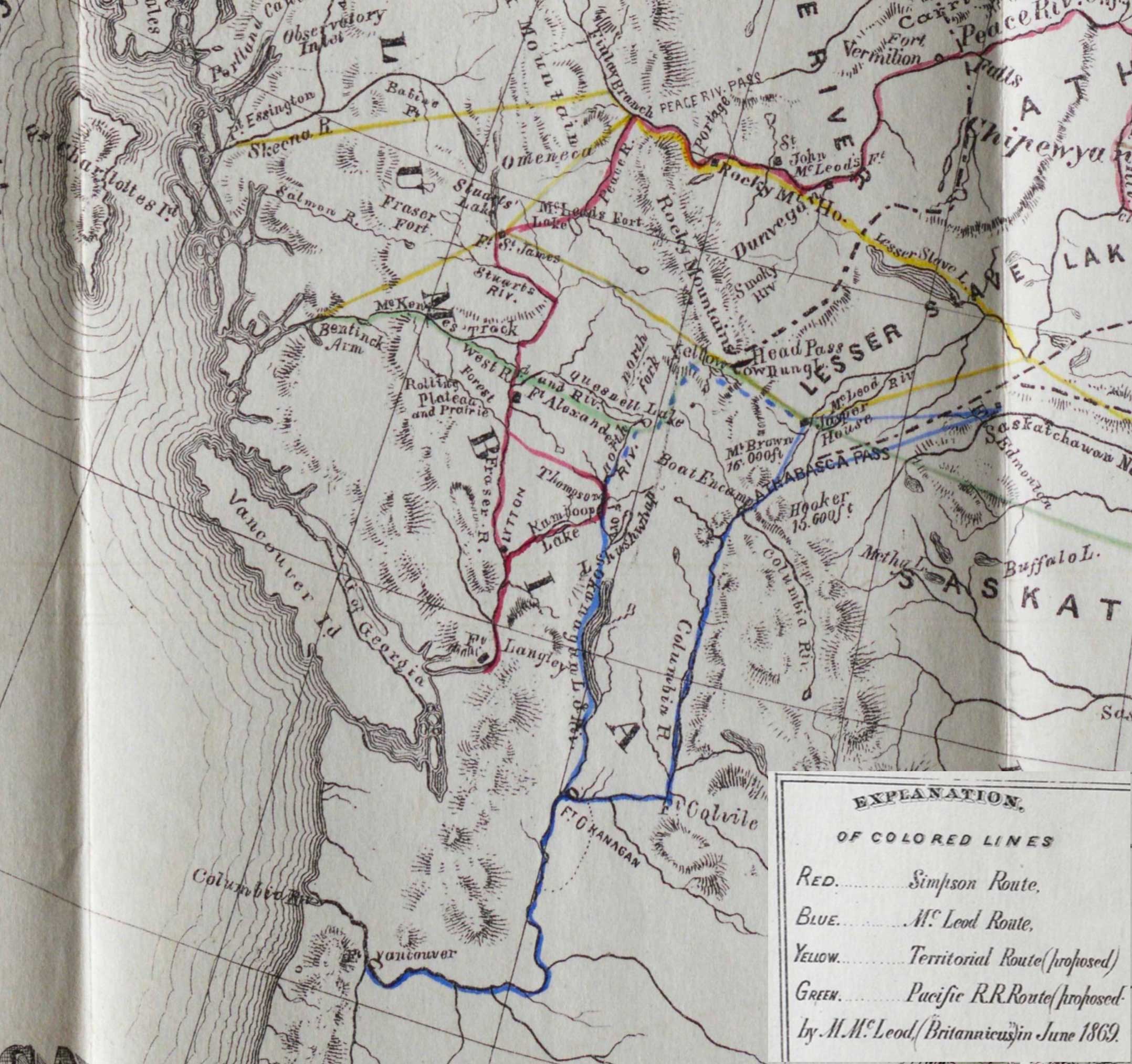
J. Arrowsmith, 1832. British North America (detail)
British North America
By Permission Dedicated to the Hon. Hudsons Bay Company
Containing the latest information which their documents furnish
By their Obedient Servant
J. Arrowsmith 1832.
Legge & Co Steam-lith./ Montreal
By Permission Dedicated to the Hon. Hudsons Bay Company
Containing the latest information which their documents furnish
By their Obedient Servant
J. Arrowsmith 1832.
Legge & Co Steam-lith./ Montreal
This edition of the map is from from Archibald McDonald’s journal of an 1828 trip accompanying George Simpson [1792–1860]. It includes a notice that the map is “Copied from original, & with latest additions.” The latest additions might be the “colored lines,” Red being the Simpson Route, Blue the McLeod Route, Yellow the proposed Territorial Route, and Green the proposed Pacific R.R. route. Additions credited to “M. McLeod (Britannicus) in June 1869.”
On the map the Athabasca River is labelled “McLeod Riv.” Fort George is not named.
References:
- McDonald, Archibald [1790–1853], and McLeod, Malcolm [1821–1899], editor. Peace River. A canoe voyage from Hudson’s Bay to Pacific, by the late Sir George Simpson (governor, Hon. Hudson’s Bay Company) in 1828. Journal of the late chief factor, Archibald McDonald, (Hon. Hudson’s Bay Company), who accompanied him. Ottawa: J. Durie & Son, 1872. University of British Columbia Library