
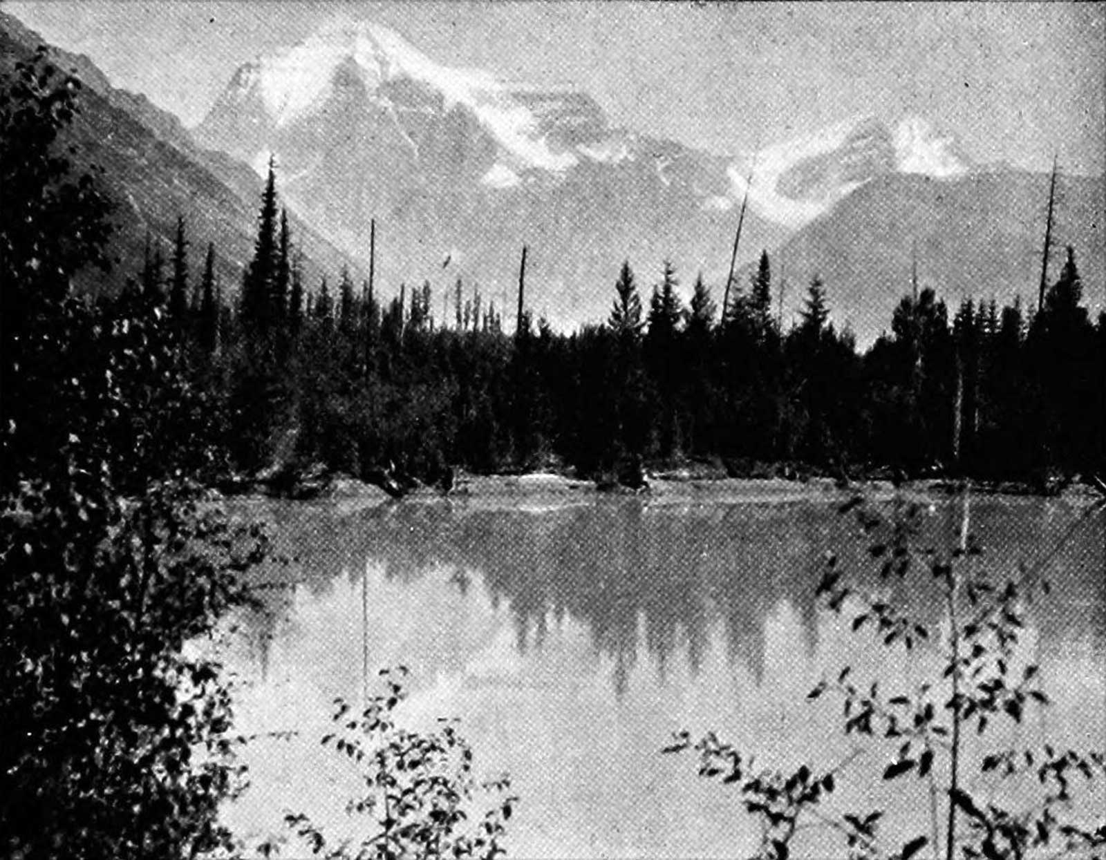
Mt. Robson, Grand Fork, Fraser River.
Photo: James McEvoy, 1898 Report on the geology and natural resources of the country traversed by the Yellowhead Pass [accessed 15 February 2025]
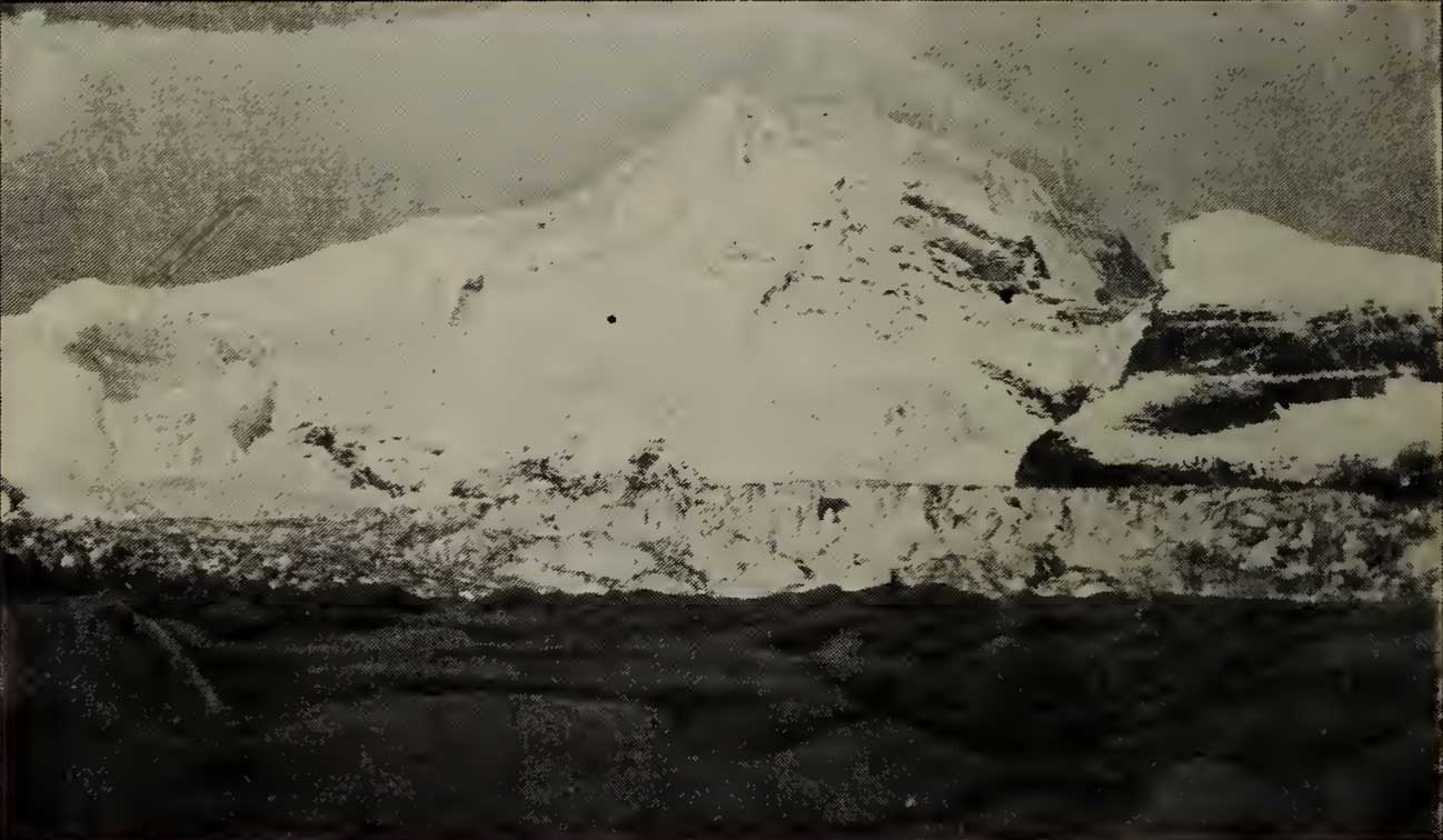
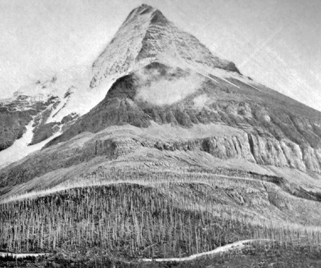
Mount Robson from the South-West, at 3,000 Feet.
Photo: Arthur Coleman, 1907 The Canadian Rockies: New and Old Trails [accessed 15 February 2025]
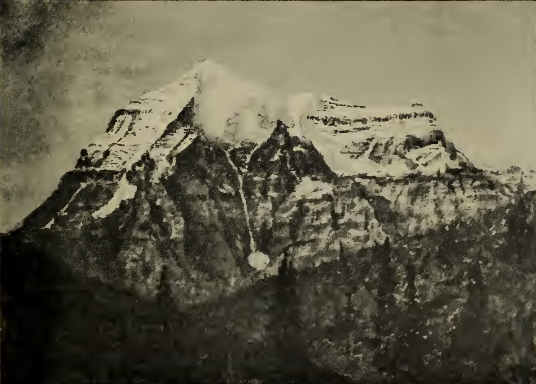
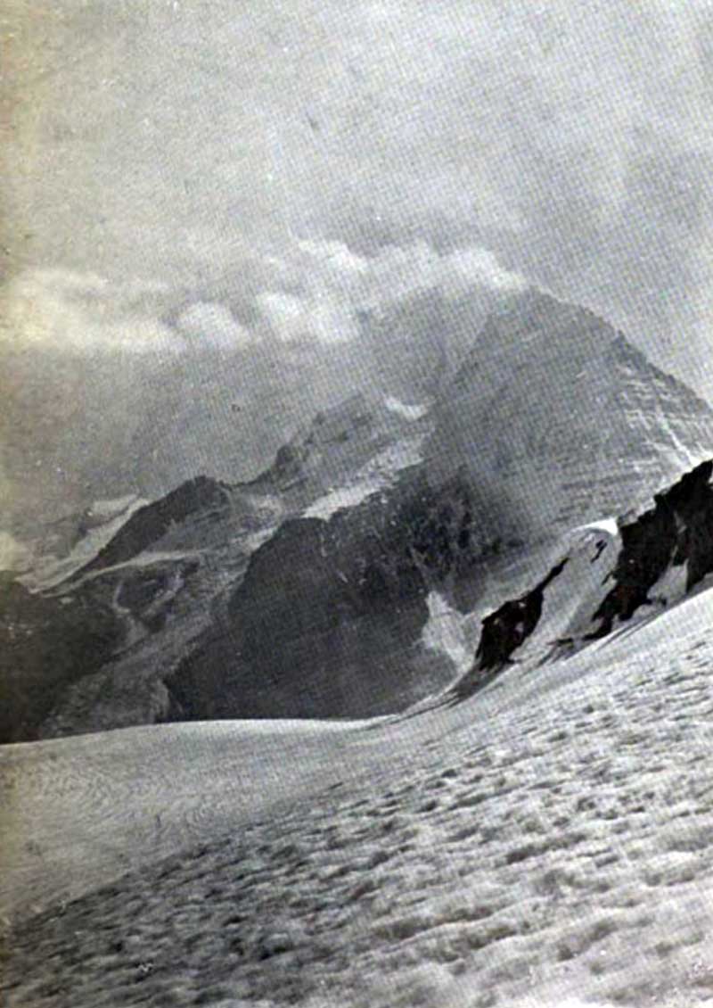
Mount Robson from the North, at 5,700 feet.
Photo: Arthur Coleman, 1907 The Canadian Rockies: New and Old Trails [accessed 15 February 2025]
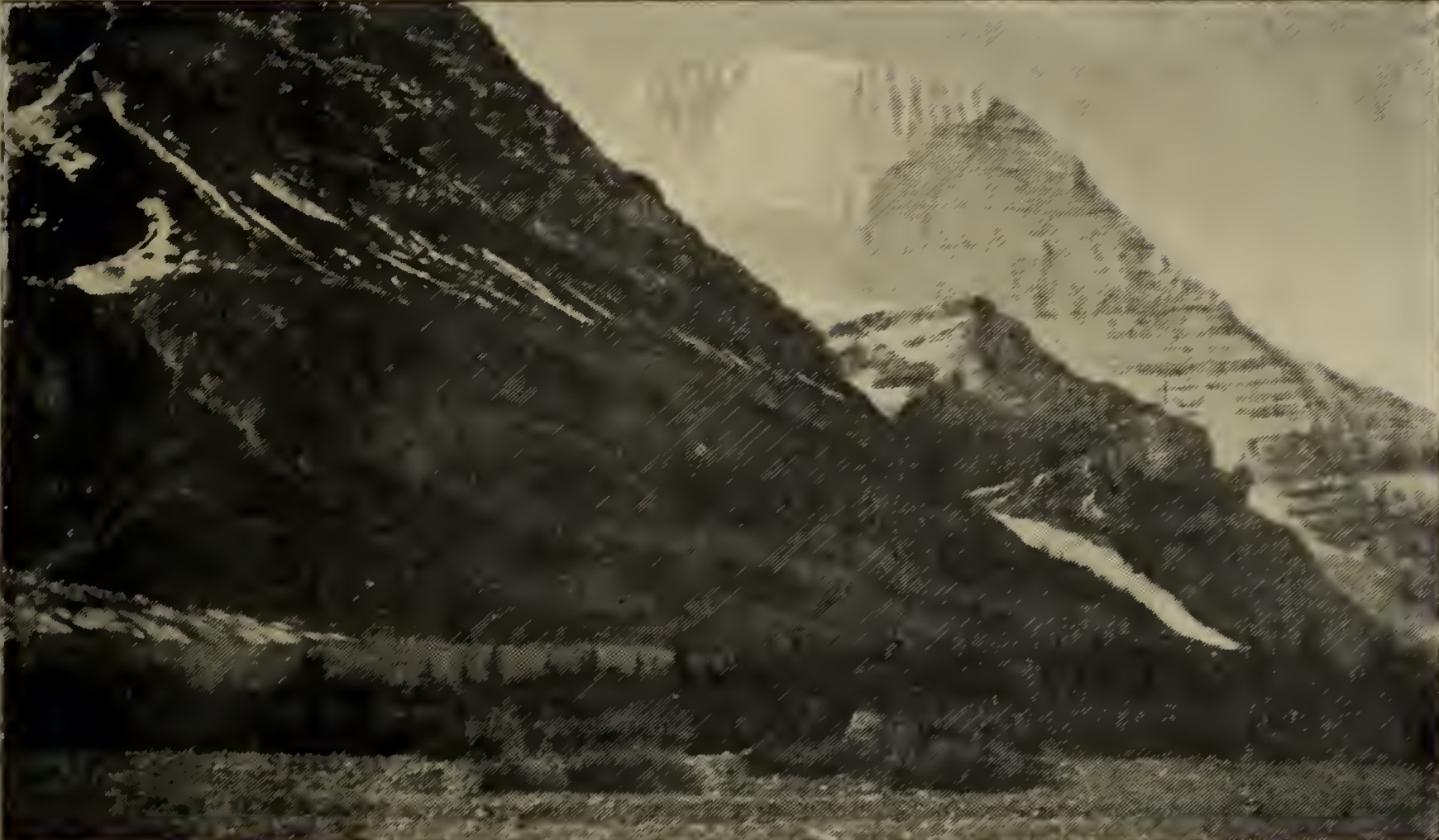
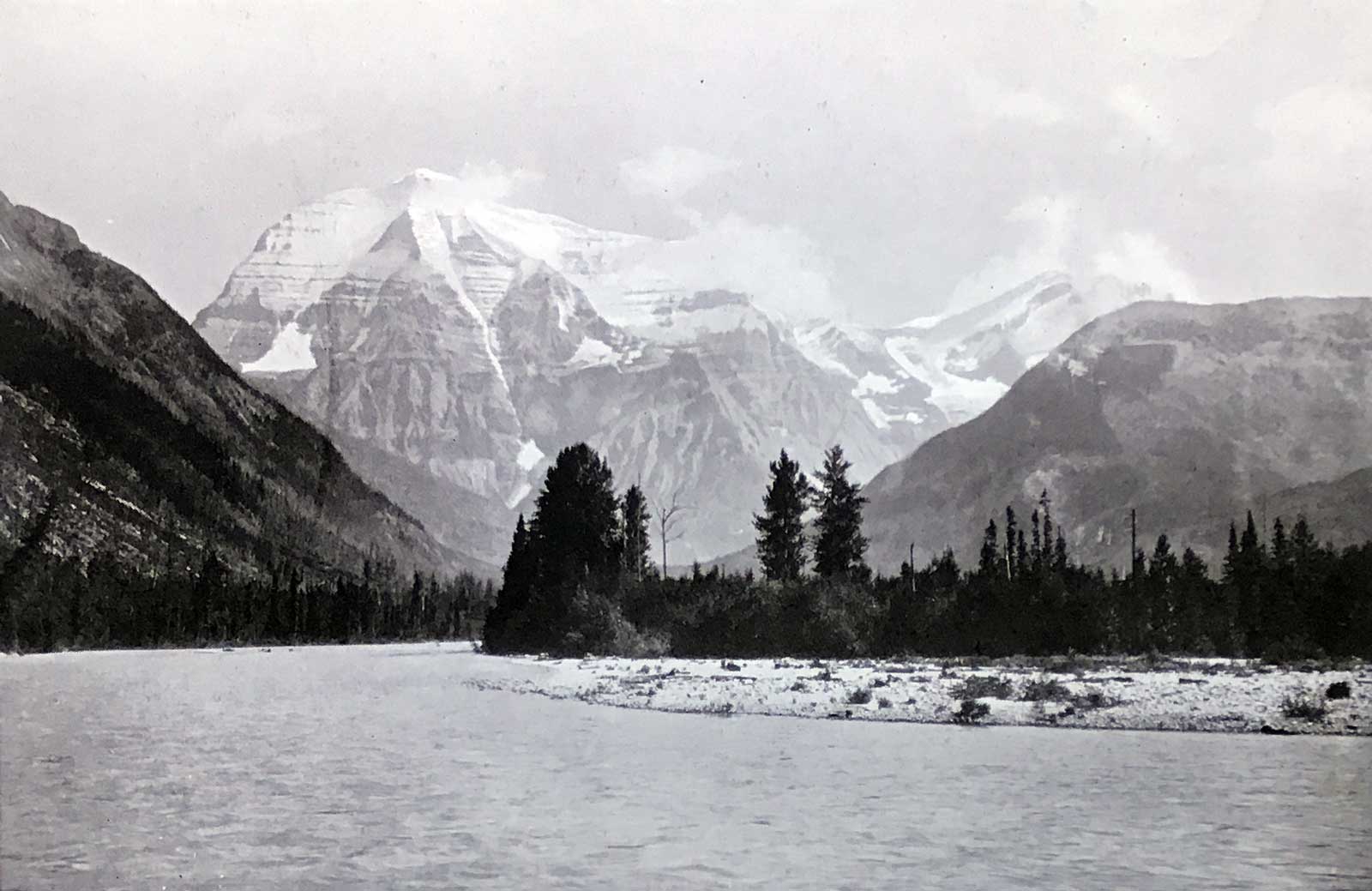
Mount Robson from the North-East, at 7,000 feet.
Photo: Arthur Coleman, 1908 The Canadian Rockies: New and Old Trails [accessed 15 February 2025]
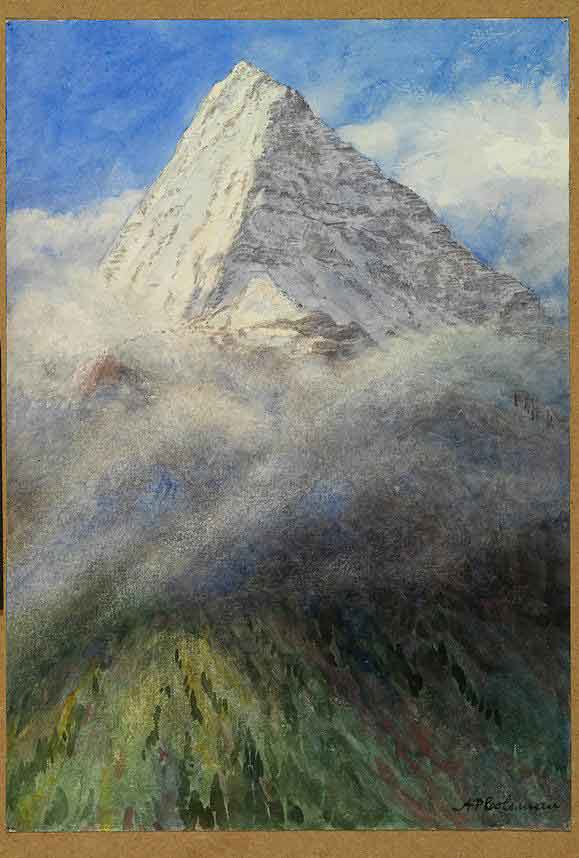
![Sunrise on Mount Robson [1908 ?] Arthur Philemon Coleman Watercolour over pencil on paper](/wp-content/uploads/2023/03/coleman-sunrise-mt-robson.jpg)
Sunrise on Mount Robson [1908 ?]
Arthur Philemon Coleman
Watercolour over pencil on paper Royal Ontario Museum [accessed 15 February 2025]
Mount Robson from North West, 1908
Arthur Philemon Coleman
Watercolour over pencil on paper Royal Ontario Museum [accessed 15 February 2025]
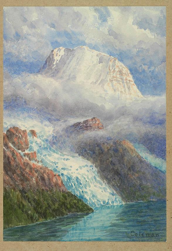
Mount Robson From Across Berg Lake, 1908
Arthur Philemon Coleman
Watercolour over pencil on paper Royal Ontario Museum [accessed 15 February 2025]
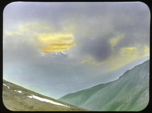
First Glimpse of Mt. Robson
Mary Schäffer Warren, 1908 Whyte Museum of the Canadian Rockies [accessed 15 February 2025]
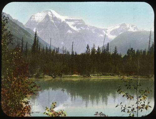
Mount Robson. Mary Schäffer Warren, 1908 Whyte Museum of the Canadian Rockies [accessed 15 February 2025]
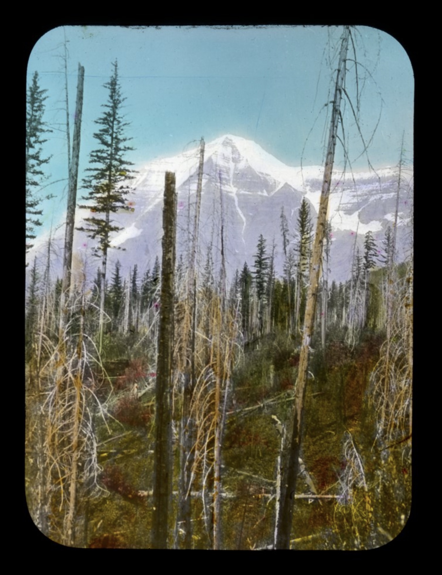
Mt. Robson from mountain near Tête Jaune Cache.
Hand coloured lantern slid, Mary Schäffer Warren, 1908 Whyte Museum of the Canadian Rockies [accessed 15 February 2025]
Mount Robson. Photo: Mary Schäffer Warren, 1908 Old Indian Trails [accessed 15 February 2025]
North-Western face of Mt. Robson from upper plateau of the Grand Forks.
Photo: A. L. Mumm, 1909 Canadian Alpine Journal 1910
Mt. Robson, from the North.
Photo: Dr. J. Norman Collie, 1910 Alpine Journal 1912 [accessed 15 February 2025]
The most majestic of Canadian Mountains.
Mount Robson, 13,700 feet high, the loftiest peak in the Canadian Rockies, viewed from the Grand Fork. 1910. F. A. Talbot, New Garden of Canada, 1911 [accessed 15 February 2025]
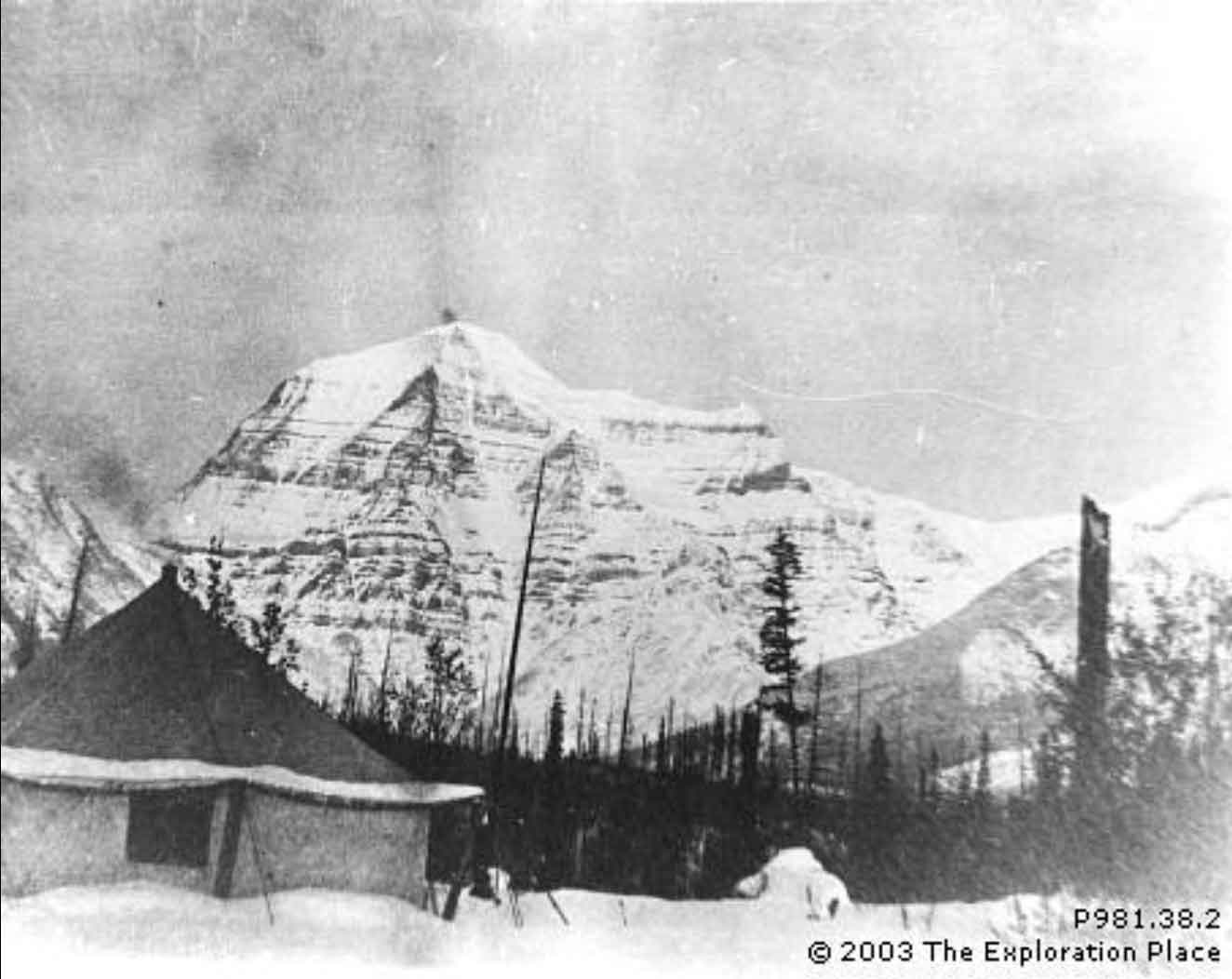
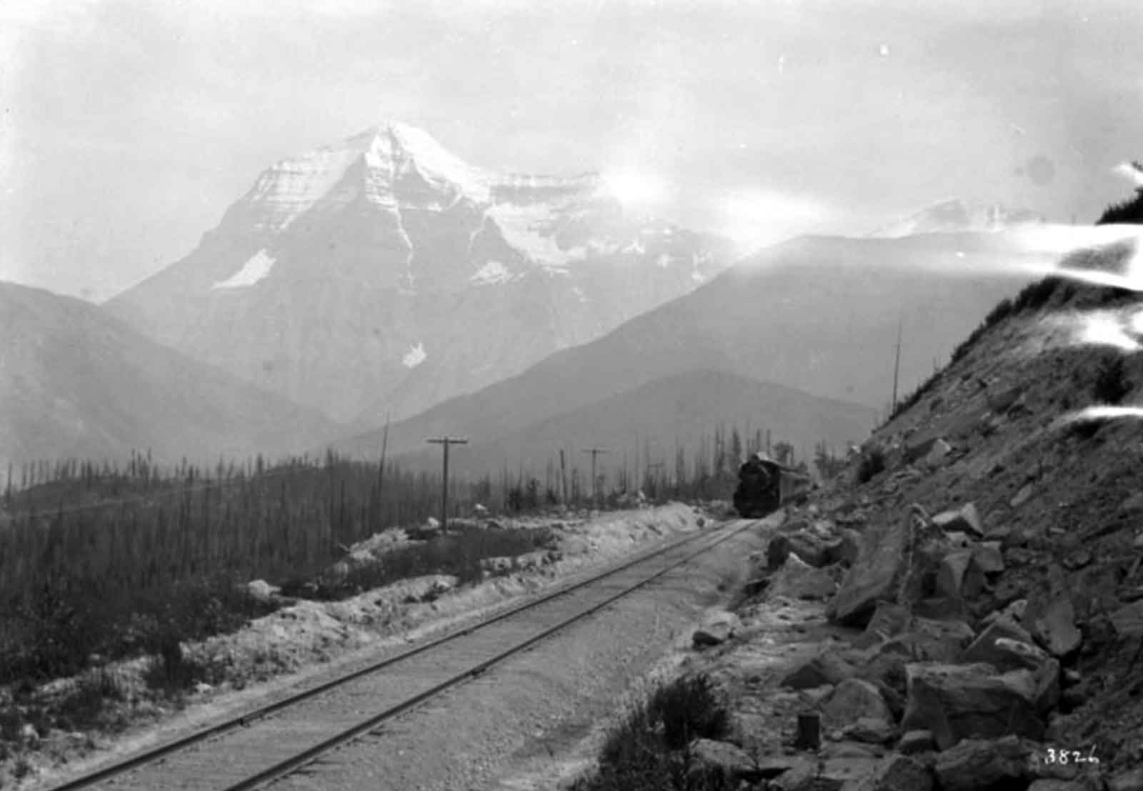
The winter camp of L. J. Cole (resident engineer) and family during Grand Trunk Pacific Railway construction, about 1910. Exploration Place [accessed 15 February 2025]
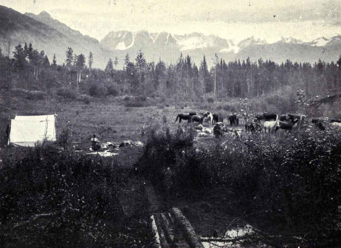
Striking camp. Mount Robson in the background.Horses coralled ready for loading up. (The Author’s camp. ) Talbot, Making Good in Canada, p. 1 [accessed 15 February 2025]
Mount Robson (Nearly 14,000 feet altitude, King of the Canadian Rockies). As the tourist on the Grand Trunk Pacific will see it from the mouth of the Grand Forks, on the Fraser River. This monster peak, towering over 10,000 feet above Lake Kinney, in the valley below, at an average angle of over 6o degrees, was finally captured, in 1909, by two Canadians. Rev. George R. B. Kinney and his companion, Donald Phillips. It the highest mountain yet discovered in the Canadian Rockies. Photo by Rev. George Kinney. National Geographic, 1911.
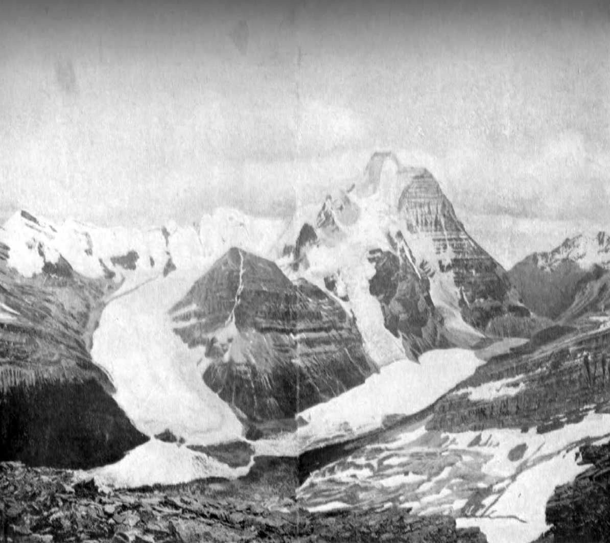
Robson Glacier, Robson Pass and Berg Lake from Mumm Peak showing northwest face of Mt. Robson. Photo: Arthur 0. Wheeler, 1911 Canadian Alpine Journal 1912
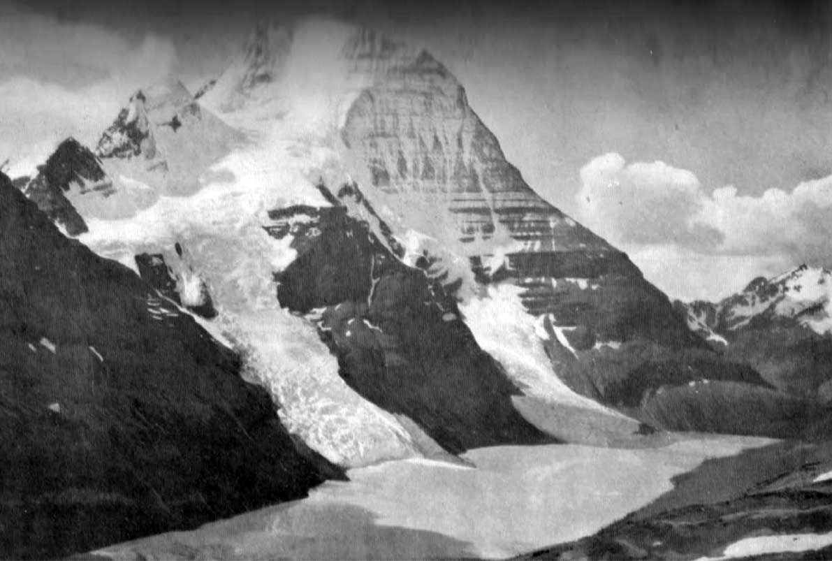
Mt. Robson and Berg Lake.
Photo: Byron Harmon, 1911 Canadian Alpine Journal 1912
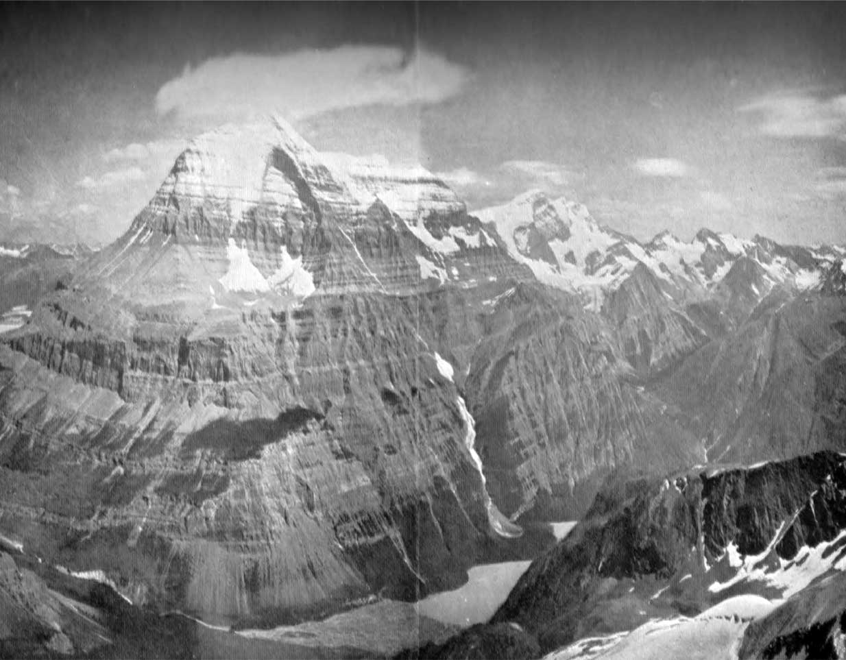
Mt. Robson, Lake Kinney and Valley of Grand Fork. Showing West and Southwest Faces of Mt. Robson. Photo: A. O. Wheeler, 1911 Canadian Alpine Journal 1912
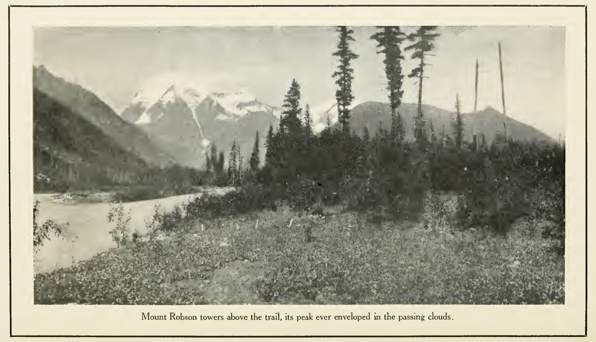
Mount Robson towers above the trail, its peak ever enveloped in the passing clouds. Stanley Washburn 1912 [accessed 15 February 2025]
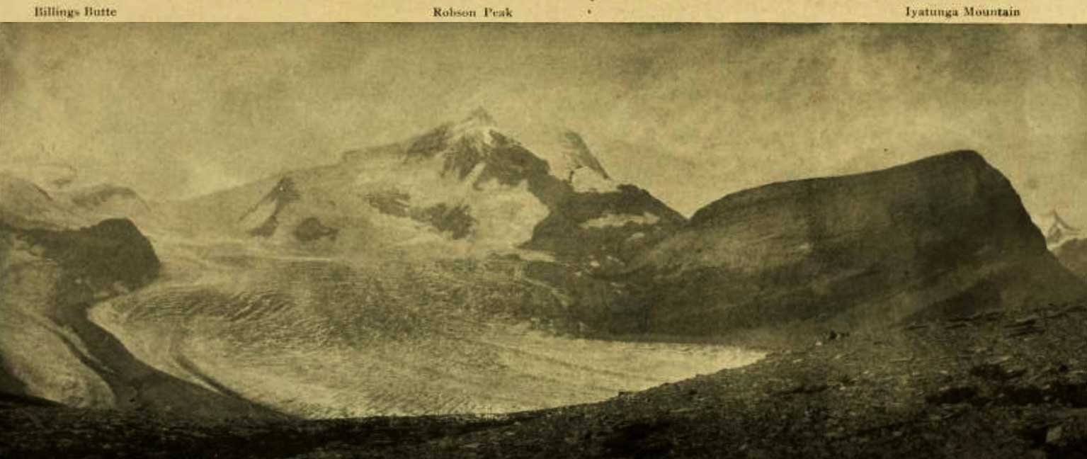
Billings Butte – Robson Peak – Iyatunga Mountain. Panonamic view of the Robson massif and adjoining mountains, with the great Hunga glacier in the foreground.
Photo: Charles D. Walcott, 1912 National Geographic Magazine 1913 [accessed 15 February 2025]
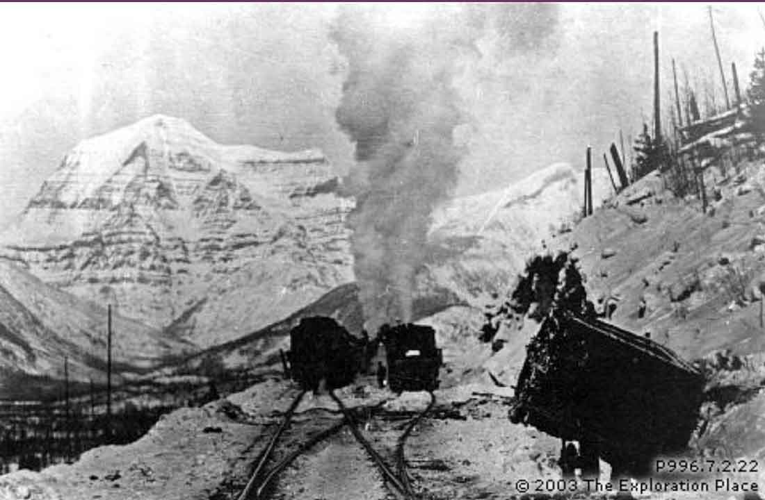
Train derailment on the main line west near Mile 13 during construction of the Grand Trunk Pacific Railway. Circa 1912. Fraser Fort George Regional Museum [accessed 15 February 2025]
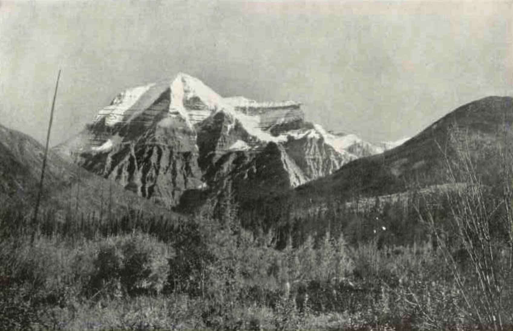
Mount Robson, B.C. from two miles below
William James Topley, 1914 Library and Archives Canada [accessed 15 February 2025]
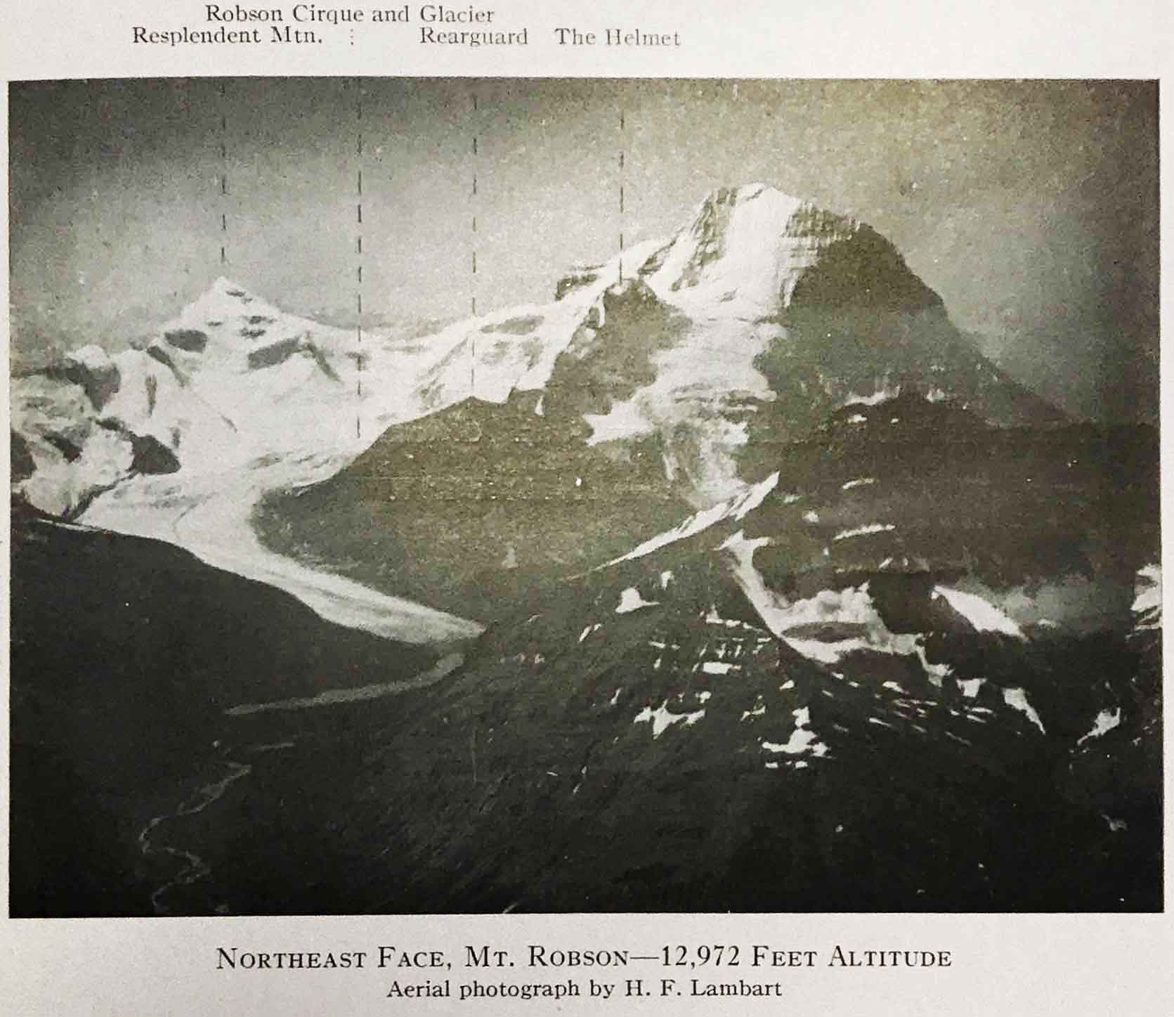
Northeast Face, Mt. Robson – 12,972 feet altitude.
Aerial photograph by H. F. Lambart, 1922
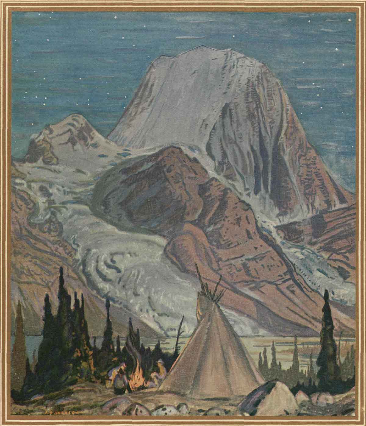
Mount Robson (12,972 feet). The Monarch of the Canadian Rockies.
A. Y. Jackson, 1927 Jasper National Park, Canadian National Railways [accessed 15 February 2025]
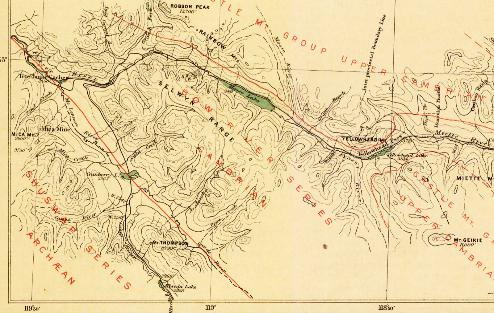
Map Showing Yellowhead Pass Route From Edmonton To Tête-Jaune Cache.
James McEvoy, 1900. (Detail) Natural Resources Canada [accessed 15 February 2025]
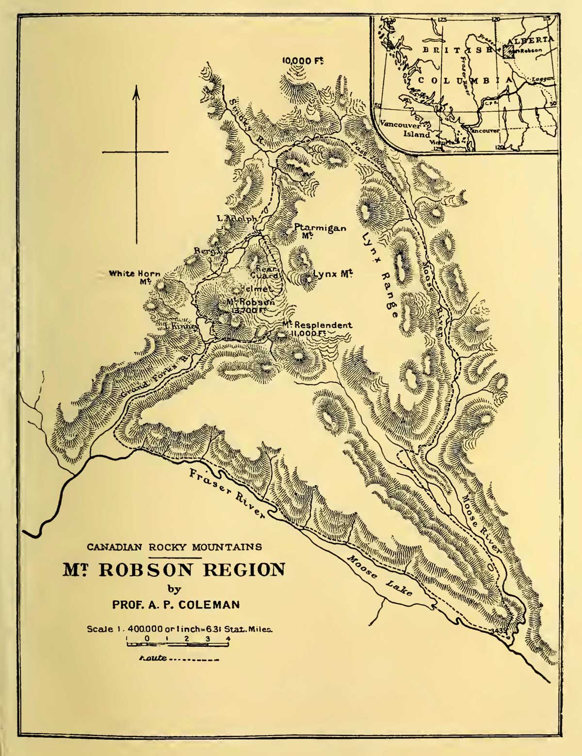
Mt. Robson Region map by A. P. Coleman, 1911 The Canadian Rockies : new and old trails, p. 264 [accessed 15 February 2025]
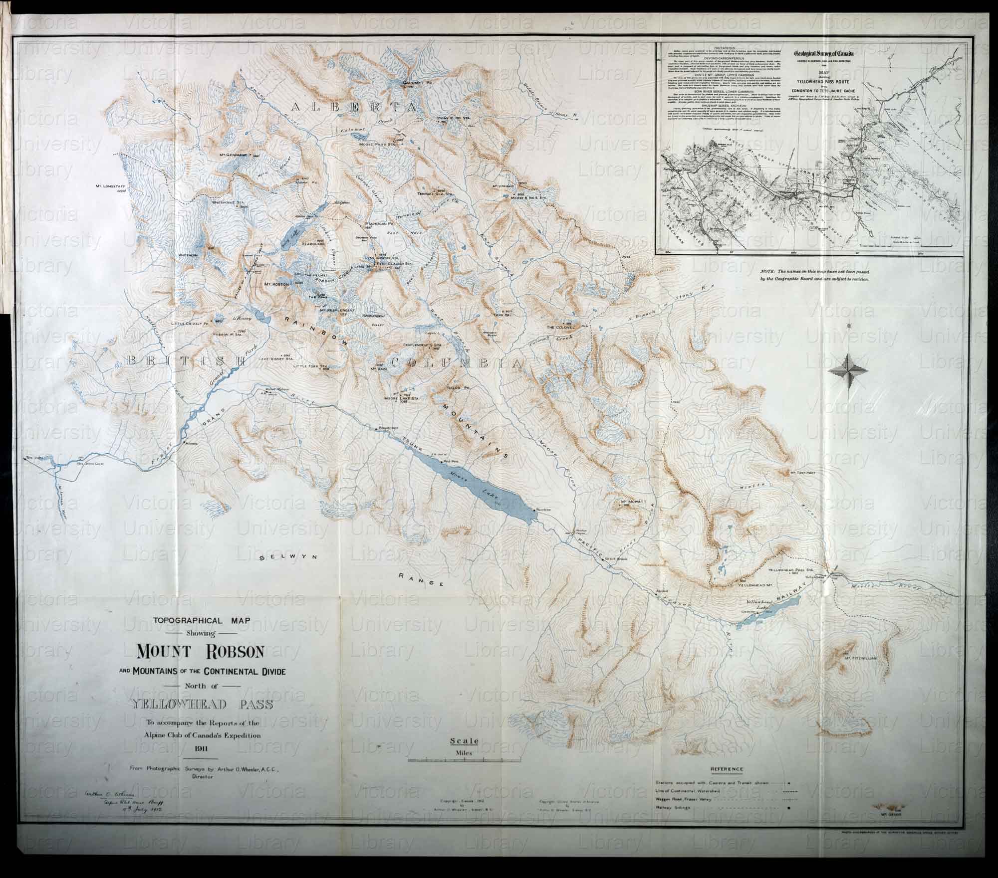
Topographical Map Showing Mount Robson and Mountains of the Continental Divide North of Yellowhead Pass.
Arthur O. Wheeler, 1912 Victoria Library, University of Toronto [accessed 15 February 2025]
- Arthur Philemon Coleman [1852–1939]
- John Norman Collie [1859–1942]
- Mount Robson (references)
- Arnold Louis Mumm [1859–1927]
- Mary T. S. Schäffer Warren [1861–1939]
- Arthur Oliver Wheeler [1860–1945]
- McEvoy, James E., P.L.S. [1862–1935]. Report on the geology and natural resources of the country traversed by the Yellowhead Pass route from Edmonton to Tête Jaune Cache comprising portions of Alberta and British Columbia. Ottawa: Geological Survey of Canada, 1900. Natural Resources Canada
- Schäffer Warren, Mary T. S. [1861–1939]. Old Indian trails. Incidents of camp and trail life, covering two years’ exploration through the Rocky Mountains of Canada. [1907 and 1908]. New York: Putnam, 1911. Internet Archive [accessed 10 March 2025]
- Coleman, Arthur Philemon [1852–1939]. The Canadian Rockies: New and Old Trails. London: T. Fisher Unwin, 1911. Internet Archive [accessed 3 March 2025]
- Walcott, Charles Doolittle [1850–1927], and Walcott Jr., Charles Doolittle [1889–1913]. “A Geologist’s Paradise.” National Geographic Magazine, 22, no. 6 (1911). Internet Archive
- Washburn, Stanley [1878–1950]. Trails, Trappers and Tenderfeet in the New Empire of Western Canada. New York and London: Henry Holt, Andrew Melrose, 1912. Hathi Trust [accessed 15 February 2025]
- Cautley, Richard William, D.L.S., A.L.S., C.E. [1873–1953], and Wheeler, Arthur Oliver [1860–1945]. Report of the Commission Appointed to Delimit the Boundary between the Provinces of Alberta and British Columbia. Parts IIIA & IIIB, 1918 to 1924. From Yellowhead Pass Northerly. Ottawa: Office of the Surveyor General, 1925. Whyte Museum
- Jasper National Park. n.p.: Canadian National Railways, 1927. Parks Canada History
- Gooch, Jane Lytton. Mount Robson: Spiral Road of Art. Victoria, B.C.: Rocky Mountain Books, 2013. Internet Archive