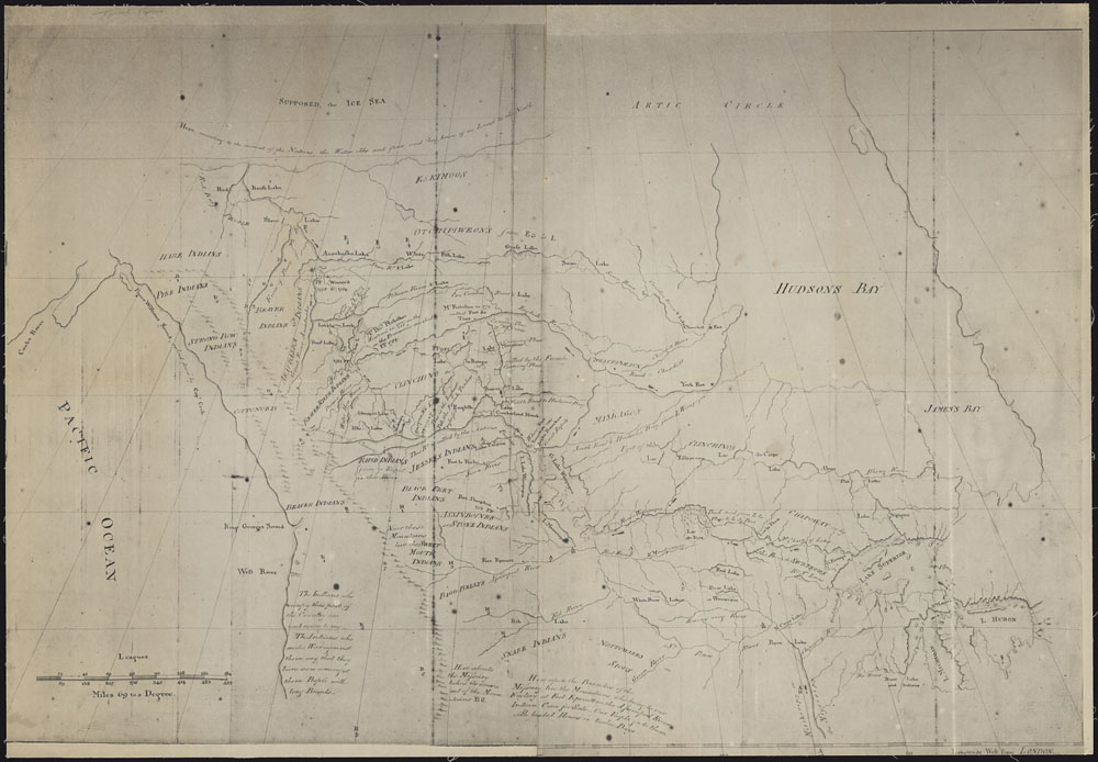
Map without title of the region from Hudson Bay to the Pacific Ocean and from Lake Michigan to the Arctic Ocean Library and Archives Canada [accessed 24 February 2025]
[Map without title of the region from Hudson Bay to the Pacific Ocean and from Lake Michigan to the Arctic Ocean]
Fur trader Peter Pond [1793–1807] pushed farther north and west than any other trader in the 1770s and 1780s. He was the first white man to cross Portage La Loche (also known as Methye Portage) to the Athabasca River and Lake Athabasca. The discovery linked the Mackenzie watershed with the rivers flowing to Hudson Bay. His activities led to the first organization named the North West Company. His reputation for violence, however, invited the suspicion of other traders both inside and outside the concern and eventually forced his withdrawal from the company.
Pond was the first to outline the general features of the Mackenzie River system. His findings fired Alexander Mackenzie [1764–1820] with the possibilities of discovery in the north and led him to follow the course of the river to its frozen mouth in 1789. Pond’s maps and suggested course of the waters of Athabasca are enduring testaments to him as a pioneer in the last great fur-bearing area of North America.
Athabasca River [as “R. Arabasca”]
Peace River [as “River of Peace”]
Tribes
Assiniboine Indians [as “Assiniboine of Canoes”]
Beaver Indians
- Gough, Barry M. Pond, Peter. University of Toronto, 1983 Dictionary of Canadian Biography, Vol 5 [accessed 25 February 2025].