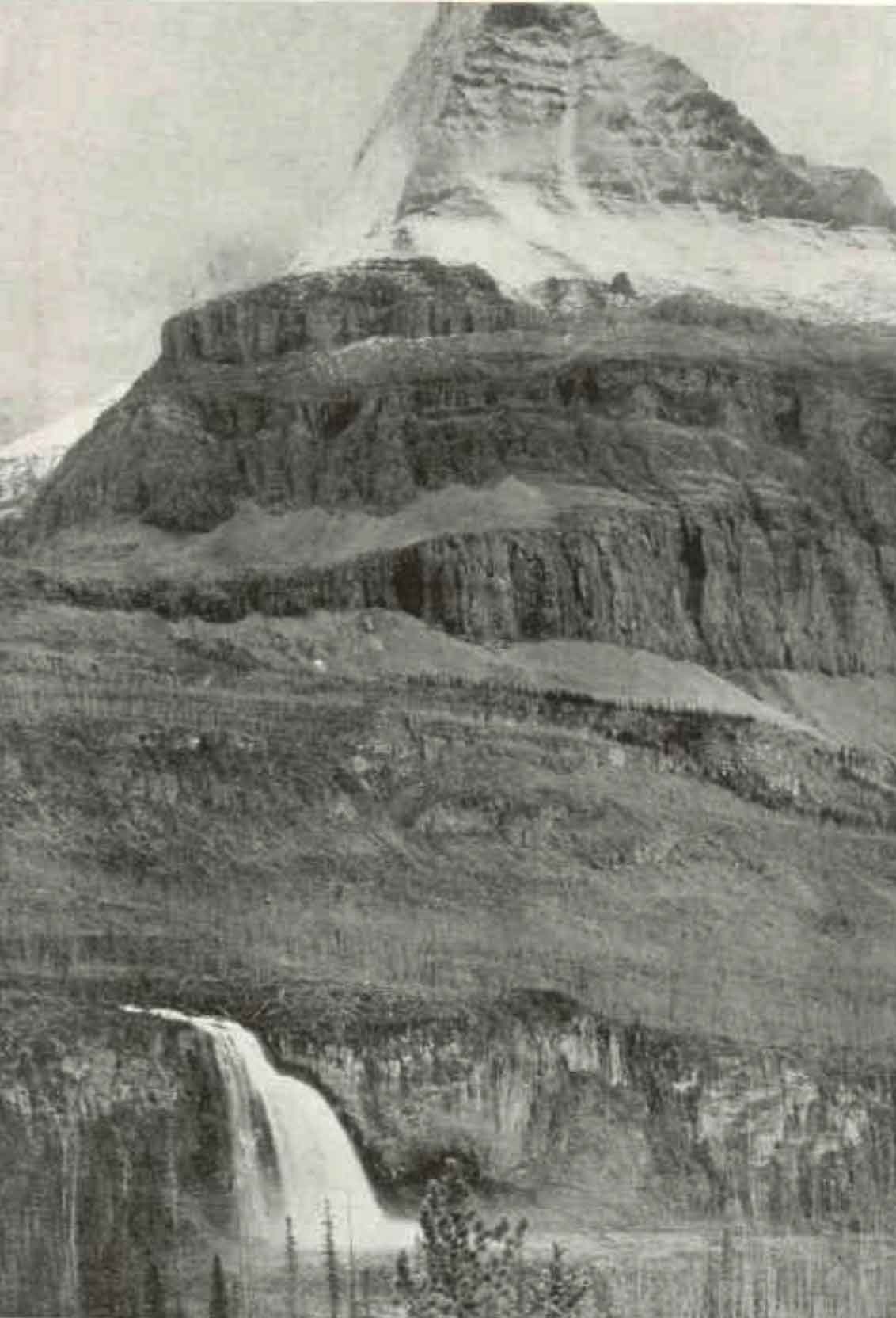
Robson River, between Berg Lake and Kinney Lake
53.1167 N 119.2 W — Map 83E/3 — Google — GeoHack
Earliest known reference to this name is 1910 (Kinney)
Name officially adopted in 1951
Official in BC – Topo map from Canadian Geographical Names
Wheeler’s map Mount Robson 1912
Boundary Commission Sheet 32 (surveyed in 1922 and 1924)

The north face of Mount Robson rises abruptly in a series of precipitos cliffs, rank on rank, to the very skies. At its base the Grand Forks River, swiftly flowing from Berg Lake, leaps a cliff as high as a Niagara and, plunging in a sccession of superb falls through a gorge over 3,000 feet deep, sweeps through the “Valley of a Thousand Falls” on its way to the Fraser. Photo by Rev. George Kinney, ca. 1907. National Geographic 1911
Dr. A. P. Coleman, Geologist of the University of Toronto, organized an expedition in 1907 to capture Mt. Robson. The party consisted of the Doctor and his brother, L.Q. Coleman, myself, and a helper. The four of us, with our pack-train of ten horses and outfit, left Laggan, August 2nd, 1907. We followed the Pipestone, Siffleur, Saskatchewan and Athabasca Rivers; crossing the Pipestone and Wilcox Passes. For weeks we made our own trails through the wilds, and forced our way through hundreds of miles of tangled underwood. We rested our weary limbs by many a beautiful lake and babbling brooklet, while our camp-fires lit the dark shadows of ravine and cliff. Rafting our stuff over the mighty Athabasca, across which we had to swim our horses, we hurried over the Yellowhead Pass, and swung down the Fraser. But our trip that year left Mt. Robson still unconquered, though we explored its western side, and I discovered Mt. Turner [Whitehorn Mountain] and “The Valley of a Thousand Falls.”
— George R. B. Kinney [1872–1961]
A little more than a mile below Berg Lake the northwest spur of Mt. Robson closely approaches the peaks across the Grand Fork Valley. Below this point is wider circle which heads in a fine glacier and icefall, previously referred to as lying beneath the east face of Mt. Whitehorn. The icefall is of a peculiar pointed shape and drops perpendicularly into a deep rock gorge opening to the lower shingle-flat, already mentioned as that through which the torrent from the glacier flows to join the Grand Fork. This circle has been named by Kinney “The Valley of a Thousand Falls.” It cannot be called a beautiful valley–tremendous cliffs and rock gorges are on every side and the feeling is one of austerity and gloom but it is very impressive and very wonderful. On a bright a sunny day the hanging and cliff glaciers on the surrounding heights of Robson and Whitehorn send down streams of water, which pour over cliffs in long, thread-like falls, some of them hundreds of feet in height. These, together with the falls already described and several others that come from the snowy peaks south of Mt. Whitehorn, give the appearance of numbers, and justify the name in some extent. Beyond the rock gorge of the glacier the eastern walls of Whitehorn rise tier on tier in awe inspiring precipices, and from between two titanic buttresses a tumbling glacier, showing a fine bunch of séracs, continually avalanches fragments to the valley below.
— Arthur Oliver Wheeler [1860–1945]
- Kinney, George Rex Boyer [1872–1961], and Phillips, Donald “Curly” [1884–1938]. “To the top of Mount Robson.” Canadian Alpine Journal, Vol. 2, No. 2 (1910):21-44. Alpine Club of Canada [accessed 2 April 2025]
- Walcott, Charles Doolittle [1850–1927], and Walcott Jr., Charles Doolittle [1889–1913]. “A Geologist’s Paradise.” National Geographic Magazine, 22, no. 6 (1911). Internet Archive
- Wheeler, Arthur Oliver [1860–1945]. “The Alpine Club of Canada’s expedition to Jasper Park, Yellowhead Pass and Mount Robson region, 1911.” Canadian Alpine Journal, Vol. 4 (1912):9-80. Alpine Club of Canada [accessed 2 April 2025]